Watershed
About the Watershed
Ever since Roger Williams arrived in 1636 and joined the Native Americans who lived in the region, the Woonasquatucket River valley has been settled by a wide variety of people from around the world. From the early settlers who farmed the land, to the immigrants of the 19th Century who built and worked in the mills, to the new wave of residents in the 20th century-each group of people has left their mark on the watershed.
They farmed, fished and built industries, leaving us with a legacy of farmhouses, mills, churches and homes that contribute to the fabric of our communities. At the mouth of the river the City of Providence grew to become the capitol of Rhode Island as well as a center for art, industry and culture.
The Woonasquatucket River’s headwaters are 300 feet above sea level at Primrose, in the town of North Smithfield. From several ponds there the river flows 19 miles south and east to downtown Providence, at sea level, where it joins the Moshassuck River to form the Providence River, which in turn flows into Narragansett Bay. The lower reaches of the river, up to the Rising Sun Dam near Donigian Park in Olneyville, rise and fall with the tide in Narragansett Bay. The name of the river derives from this because to the Native Americans who lived here “Woonasquatucket” (woon-AHS-kwa-tuk-it) meant “the place where the salt water ends” or the meeting of the river and the sea.
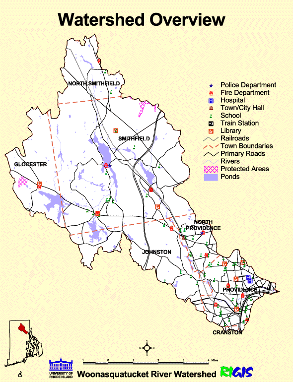
While the river itself is only 19 miles long, the Woonasquatucket watershed covers 50 square miles in the towns of North Smithfield, Smithfield, Johnston, North Providence, and Providence. Nestled between the Blackstone, Moshassuck, and Pawtuxet watersheds, it encompasses all the land where precipitation and groundwater eventually drain to the Woonasquatucket.
Map courtesy of the Rhode Island Critical Resources Atlas.

